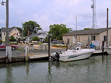
Category:Smith Island, Maryland
Jump to navigation
Jump to search
island on the Chesapeake Bay, on the border of Maryland and Virginia territorial waters in the United States | |||||
| Upload media | |||||
| Instance of | |||||
|---|---|---|---|---|---|
| Location | Somerset County, Maryland | ||||
| Population |
| ||||
| Area |
| ||||
| Elevation above sea level |
| ||||
 | |||||
Subcategories
This category has the following 3 subcategories, out of 3 total.
G
S
- Smith Island Cake (3 F)
Media in category "Smith Island, Maryland"
The following 45 files are in this category, out of 45 total.
-
2021-06-27 01 Ewell harbor view of Smith Island, MD USA.jpg 6,327 × 1,756; 6.75 MB
-
2021-06-27 02a Ewell harbor view of Smith Island, MD USA.jpg 8,358 × 1,810; 8.86 MB
-
2021-06-27 02b Smith Island, MD USA - WikiV banner.jpg 5,915 × 845; 3.49 MB
-
-
Biologist Robbie Callahan holds brown pelican for tagging. (8903625190).jpg 4,288 × 2,848; 6.38 MB
-
Black & White Photos (8483925227).jpg 1,280 × 960; 652 KB
-
Breakwater construction close to completion (21427391111).jpg 3,456 × 2,304; 3.73 MB
-
Maryland - Ewell - NARA - 23941063.jpg 4,385 × 3,382; 3.86 MB
-
Ewell Maryland Post Office 21824.jpg 2,048 × 1,536; 616 KB
-
Flag of Smith Island, Maryland (unofficial).png 400 × 240; 4 KB
-
Flag of Smith Island, Maryland.svg 1,000 × 500; 957 bytes
-
Fog Point living shoreline - Matt Whitbeck, project leader (20796264084).jpg 3,888 × 2,592; 2.79 MB
-
Maryland - Smith Island - NARA - 23941207.jpg 4,385 × 3,382; 3.07 MB
-
Maryland - Smith Island - NARA - 23941209.jpg 4,385 × 3,382; 2.95 MB
-
Pelecanus occidentalis -Smith Island, Chesapeake Bay, Maryland, USA -nest-8cr.jpg 2,639 × 2,021; 4.42 MB
-
Smith Island living shoreline sand placement (21230879230).jpg 3,888 × 2,592; 2.47 MB
-
Smith Island, Maryland (6632605935).jpg 1,280 × 960; 305 KB
-
Smith Island, Maryland (6632606309).jpg 1,280 × 960; 382 KB
-
Smith Island, Maryland (6632606617).jpg 1,280 × 960; 347 KB
-
Smith Island, Maryland (6632606977).jpg 1,280 × 960; 369 KB
-
Smith Island, Maryland (6632607375).jpg 1,280 × 960; 388 KB
-
Smith Island, Maryland (6632607867).jpg 1,280 × 960; 562 KB
-
Smith Island, Maryland (6632608307).jpg 1,280 × 960; 401 KB
-
Smith Island, Maryland (6632608765).jpg 1,280 × 960; 484 KB
-
Smith Island, Maryland (6632609261).jpg 1,280 × 960; 504 KB
-
Smith Island, Maryland (6632610317) (2).jpg 1,280 × 960; 640 KB
-
Smith Island, Maryland (6632610761).jpg 1,280 × 960; 446 KB
-
Smith Island, Maryland (6632611153).jpg 1,280 × 960; 467 KB
-
Smith Island, Maryland (6632611755).jpg 1,280 × 960; 616 KB
-
Smith Island, Maryland (6632612301).jpg 1,280 × 960; 688 KB
-
Smith Island, Maryland (6632612893).jpg 1,280 × 960; 728 KB
-
Smith Island, Maryland (6632613389).jpg 1,280 × 960; 631 KB
-
Smith Island, Maryland (6632613919).jpg 1,280 × 960; 632 KB
-
Smith Island, Maryland (6632614281).jpg 1,280 × 960; 411 KB
-
Smith Island, Maryland (6632614641).jpg 1,280 × 960; 450 KB
-
Smith Island, Maryland (6632614931).jpg 1,280 × 960; 285 KB
-
Smith Island, Maryland (6632615329).jpg 1,280 × 960; 423 KB
-
Smith Island, Maryland (6632615727).jpg 1,280 × 960; 365 KB
-
Smith Island, Maryland (6632616077).jpg 1,280 × 960; 402 KB
-
Smith Island, Maryland (6632616357).jpg 1,280 × 960; 331 KB
-
Smith Island, Maryland (6632616673).jpg 1,280 × 960; 347 KB
-
Smith Island, Maryland (6632617567).jpg 1,280 × 960; 576 KB
-
Tylerton.jpg 1,200 × 900; 211 KB
-
WWW FL (6996001980).jpg 4,272 × 2,848; 5.66 MB


